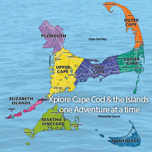
You can see from the Cape Cod Map that it is shaped like a hook, extending approximately 65 miles into the Atlantic Ocean. It varies in width, with the narrowest point being just over a mile wide.
Cape Cod, located in the easternmost portion of the state of Massachusetts, is not an island in the traditional sense but rather a peninsula that juts out into the Atlantic Ocean, separated by the man-made Cape Cod Canal and connected by two bridges to the mainland. While Cape Cod itself is not an island, there are several smaller islands located nearby, including Martha’s Vineyard, Nantucket and the Elizabethan Islands. These islands are accessible by ferry from various points on Cape Cod or New Bedford.
Understanding the Map of Cape Cod
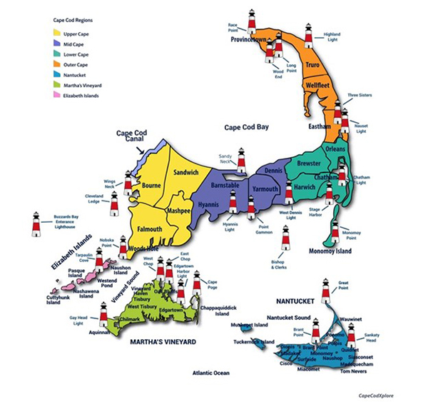
Cape Cod is often divided into several regions based on its geography. These regions, color-coded on the Cape Cod Map, include the Upper Cape (the area closest to the mainland), the Mid-Cape, the Lower Cape, and the Outer Cape (including the towns of Wellfleet, Truro, Provincetown, and parts of Eastham). Use the Map of the Cape Cod Towns below to identify which region they lie in.
Map Cape Cod
Topography of the Cape Cod Map
The landscape of Cape Cod is characterized by sandy beaches, dunes, salt marshes, and coastal bluffs. Glacial activity during the last Ice Age shaped much of its topography, leaving behind features like kettle ponds and drumlins.
Cape Cod is renowned for its beautiful beaches, which attract visitors from around the world. Some of the most popular beaches include Coast Guard Beach, Nauset Beach, Marconi Beach, and Race Point Beach. A significant portion of Cape Cod’s coastline is protected as part of the Cape Cod National Seashore, which encompasses beaches, dunes, salt marshes, and historic sites.
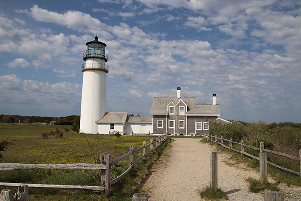
Lighthouses on the Cape Cod Map
There are 27 lighthouses found on the map of Cape Cod, each with its own unique history and charm. From Highland Light (Cape Cod Light), one of the oldest and tallest lighthouses on Cape Cod to Nauset Light, situated in Eastham, known for its distinctive red and white stripes, there are many iconic lighthouses sprinkled across the Cape Cod Map. All are popular spots for visitors to take photographs.
Navigating Your Way Around the Cape
Navigating your way around Cape Cod can be a delightful experience, with its picturesque landscapes, charming towns, and scenic coastal views. There are several main roads that traverse the Cape, including Route 6 (the Mid-Cape Highway) and Route 28. An alternate more scenic route is, Route 6A (the Old King’s Highway), which winds through historic villages and offers glimpses of colonial architecture and lush landscapes.
During the summer months, especially on weekends, you will want to factor in the traffic and consider alternate back routes, as guided by your GPS or map of Cape Cod towns. Plan your travel times accordingly and be patient, especially when traveling on the main roads and bridges
The Cape Cod Regional Transit Authority (CCRTA) operates bus services that connect various towns on the Cape. Additionally, the CapeFlyer train runs between Boston and Hyannis during the summer months, providing an alternative mode of transportation to beat the traffic. Or consider biking to beat the traffic and explore Cape Cod, especially along the Cape Cod Rail Trail and the Shining Sea Bikeway. These scenic bike paths offer a safe and enjoyable way to experience the beauty of the Cape at a leisurely pace.
If you’re visiting Cape Cod’s beaches, be sure to check for beach access points and parking information ahead of time. Some beaches require permits for parking, while others may have limited parking availability, especially during peak season.
 Navigating Your Way to the Islands
 Navigating Your Way to the Islands
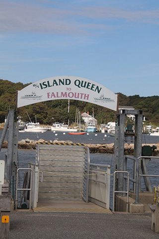
If you’re planning to visit nearby islands like Martha’s Vineyard or Nantucket, unless you have your own boat, you will need to take a ferry from one of Cape Cod’s ferry terminals. Ferry services operate regularly during the summer months and offer a convenient way to explore the region. Check our ferry schedules to find the one that fits your schedule.
Cape Exploration
The Cape provides numerous opportunities for outdoor recreation and wildlife exploration. Overall, the map of Cape Cod and its geographic makeup is characterized by its scenic coastline, sandy beaches, and unique coastal ecosystems, making it a popular destination for outdoor enthusiasts,